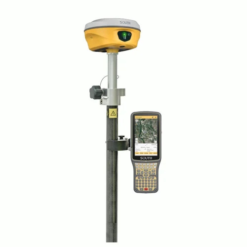
About Laser DGPS ALPS2 System
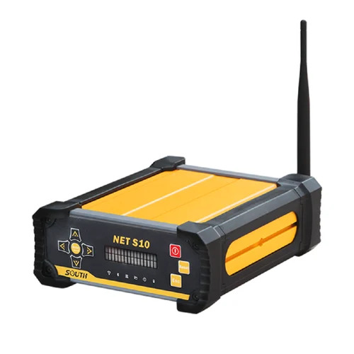
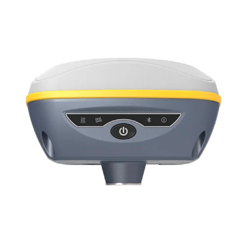
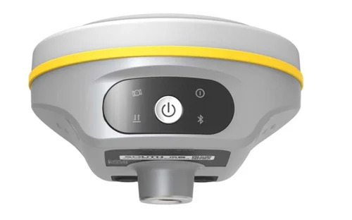
Last Chance to reserve your Blue-ribbon Laser DGPS ALPS2 System! Grab yours now and experience the transcendent accuracy of dual-frequency positioning. Designed in striking yellow and black, this astonishing system offers horizontal accuracy under 1 cm, enviable GNSS compatibility (GPS, NavIC, BeiDou, Galileo, GLONASS), and a robust IP66 ingress rating for complete dust and high water protection. Weighing approximately 1.1 kg with a tough aluminium pole and multiple connectivity options (USB, Bluetooth, 4G, UHF, WiFi), this Base+Rover system assures versatile performance in challenging conditions from -30C to +65C. Internal memory and advanced data interfaces guarantee seamless operations. Includes Base, Rover, and Pole-reserve now before stocks vanish!
Versatile Field Applications for the Laser DGPS ALPS2 System
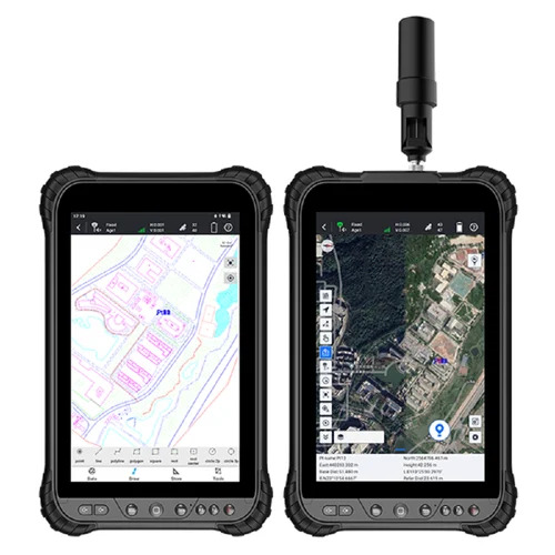
The Laser DGPS ALPS2 System is perfectly suited for land surveying, construction layout, infrastructure development, and geospatial mapping. Used for precision measurements, stakeouts, or data collection, it serves surveyors, civil engineers, and GIS professionals alike. It is also ideal for agricultural field mapping, cadastral surveys, and urban planning projects. With its extraordinary tilt, laser, and bubble survey modes, the ALPS2 System covers a wide spectrum of advanced surveying applications with remarkable ease.
Laser DGPS ALPS2: Payment Terms, Delivery Time, and Sampling
Payment for the Laser DGPS ALPS2 System can be arranged based on mutually agreed upon expenditure plans. We offer competitive rates for both bulk and single-unit orders. Fast and secure transportation ensures prompt delivery, with typical lead times discussed at order confirmation. Samples are available upon request, subject to specific agreements. Our streamlined process gives you confidence and clarity while securing this advanced positioning equipment.
FAQ's of Laser DGPS ALPS2 System:
Q: How accurate is the Laser DGPS ALPS2 System for field survey operations?
A: The Laser DGPS ALPS2 System provides astonishing positional accuracy, delivering less than 1 cm horizontal error, and vertical precision down to 3.5 mm + 0.5 ppm RMS in static mode. Its advanced GNSS capabilities make it an exceptional choice for demanding survey tasks.
Q: What connectivity features does this system offer for real-time data transfer?
A: The system supports USB, Bluetooth, 4G modem, UHF radio, and WiFi connectivity, enabling seamless data transfer and real-time communication between devices and survey teams in the field.
Q: When should I choose the Laser DGPS ALPS2 over conventional GPS systems?
A: Choose the ALPS2 System when your projects require blue-ribbon accuracy, robust environmental protection, and multi-constellation GNSS tracking. Its advanced features outperform basic GPS devices, especially on multidimensional, high-stakes jobs.
Q: Where can the Laser DGPS ALPS2 System be deployed effectively?
A: With an operating temperature range from -30C to +65C and IP66 ingress rating, this device can be effectively deployed in harsh outdoor environments including construction sites, open agricultural lands, and urban developments alike.
Q: What is the process for reserving and acquiring this system in India?
A: To reserve or acquire the Laser DGPS ALPS2 System, contact our importer and supplier division in India. Flexible payment terms and rapid transportation options are available to streamline your procurement process.
 Send Inquiry


 Send Inquiry